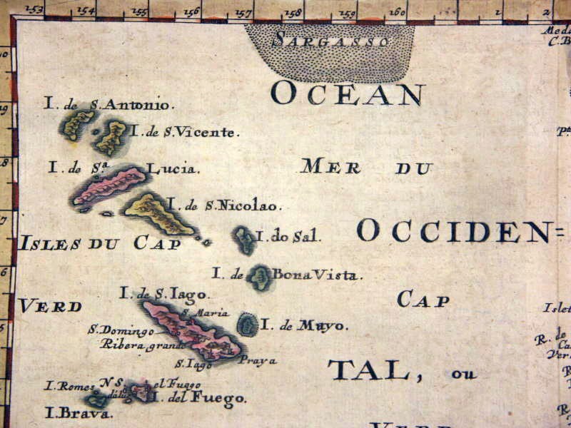
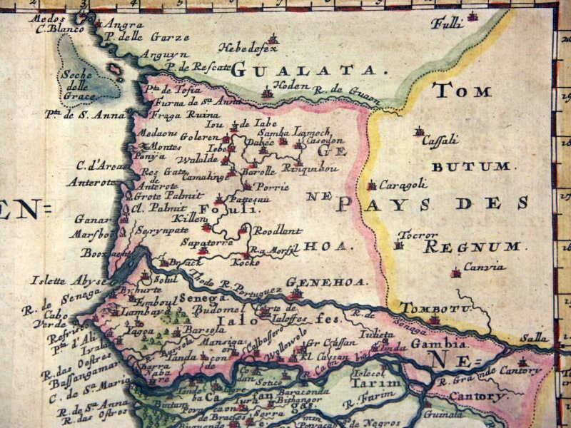
Overview of Historical Maps of the Cape Verde Islands
- with a focus on Santiago -
COPYRIGHTS: if you think your copyrights are violated, please contact me!
1468 Benincasa (1) | 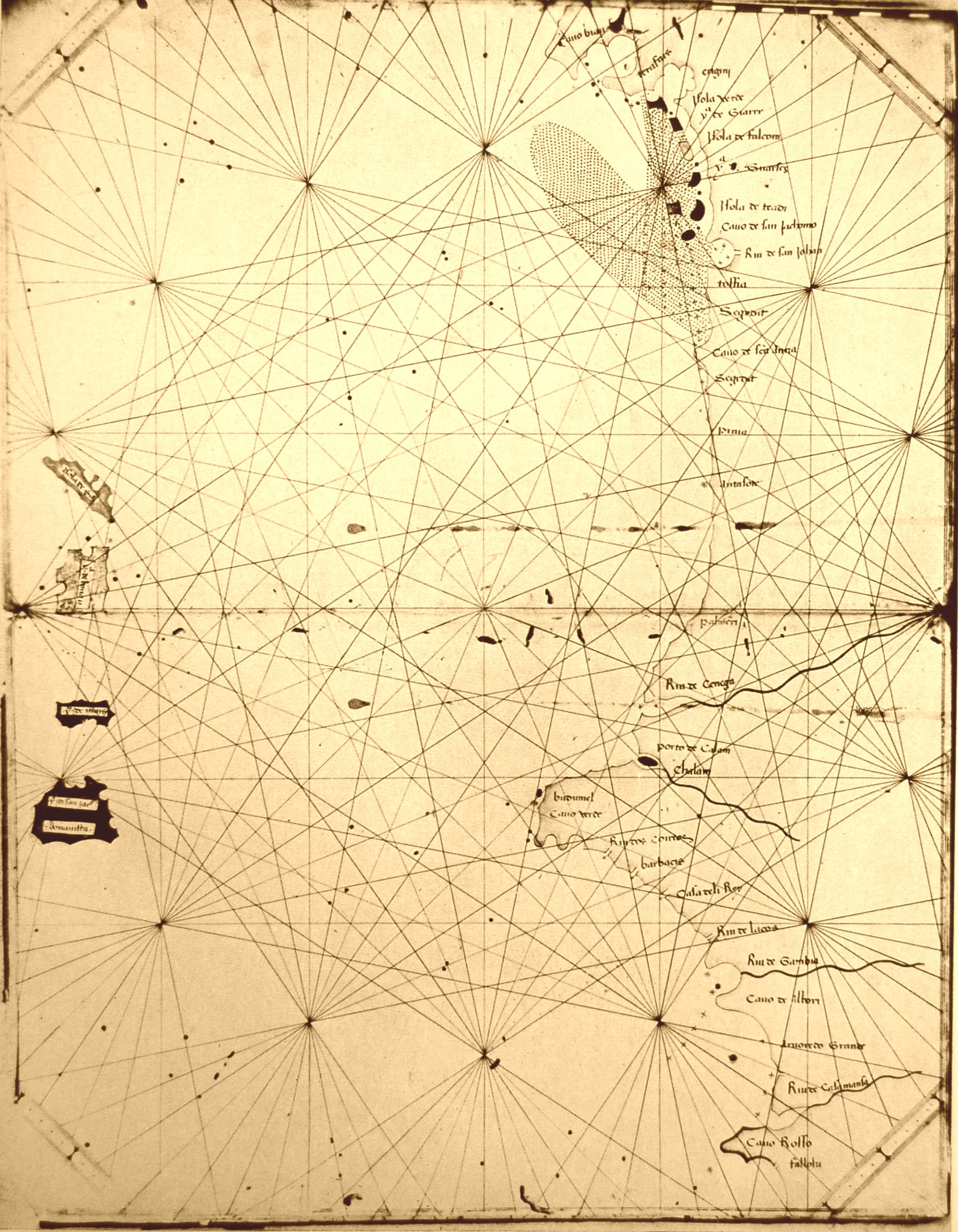 | [Source: Garcia de Orta - Cinco seculos de cartografia das ilhas de Cabo Verde, A. Teixeira da Mota (1961)] |
1468 Benincasa (2) |  | [Source: Garcia de Orta - Cinco seculos de cartografia das ilhas de Cabo Verde, A. Teixeira da Mota (1961)] |
1469 Benincasa |  | [Source: Garcia de Orta - Cinco seculos de cartografia das ilhas de Cabo Verde, A. Teixeira da Mota (1961)] |
1506-1508 FernandesSantiago | 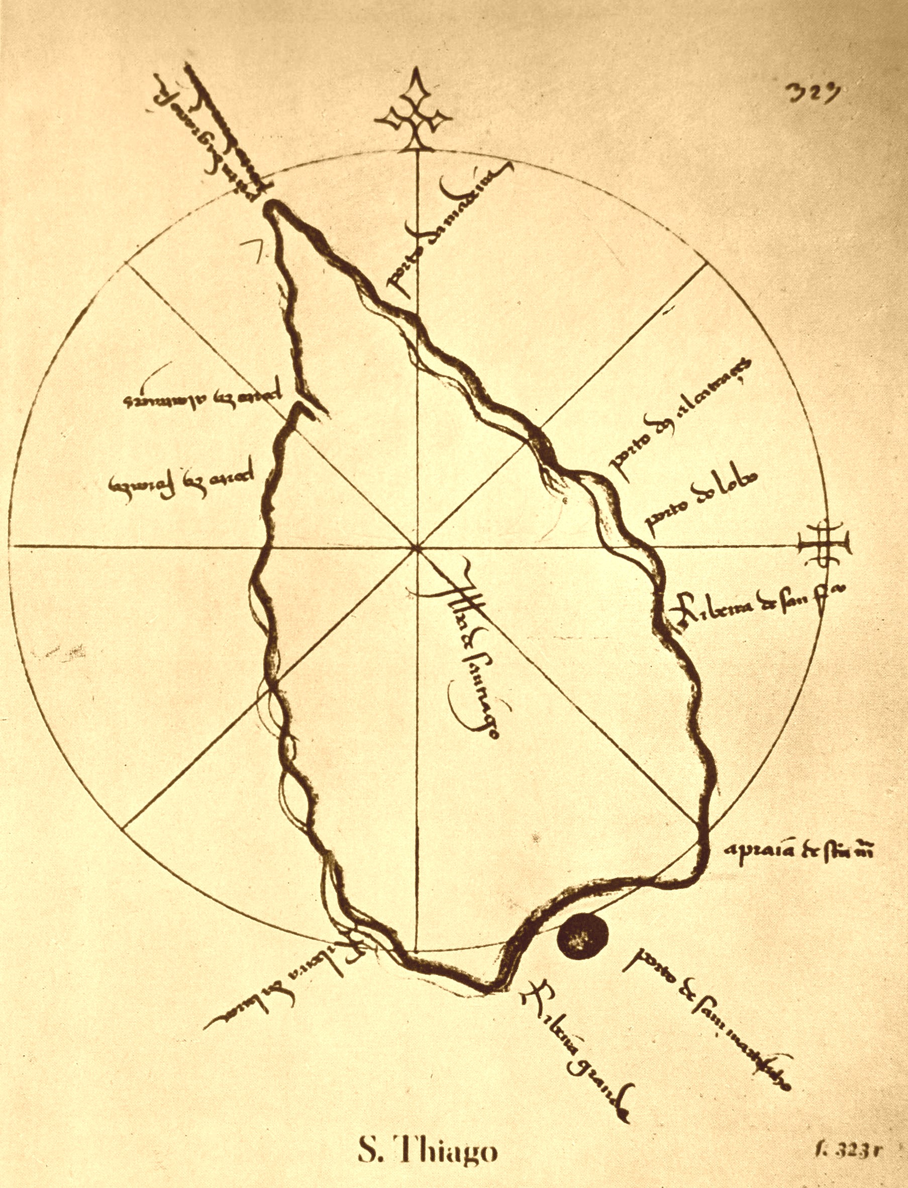 | [Source: Garcia de Orta - Cinco seculos de cartografia das ilhas de Cabo Verde, A. Teixeira da Mota (1961)] |
1589 HondiusSantiago | 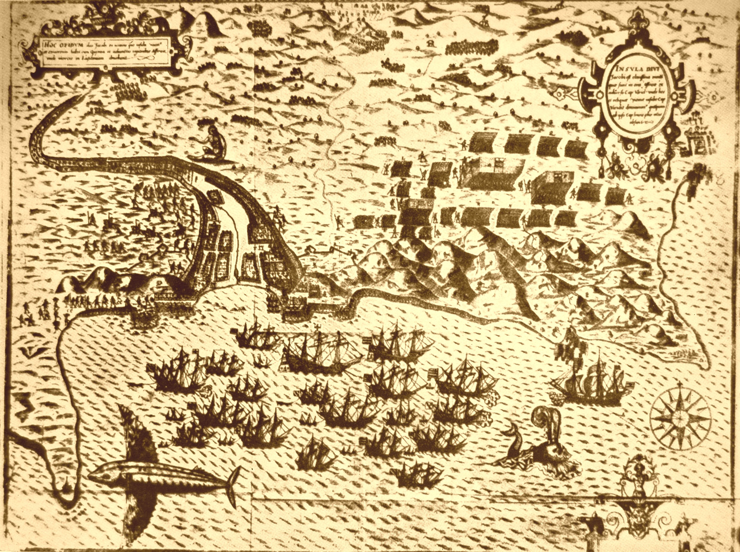 | [Source: Garcia de Orta - Cinco seculos de cartografia das ilhas de Cabo Verde, A. Teixeira da Mota (1961)] |
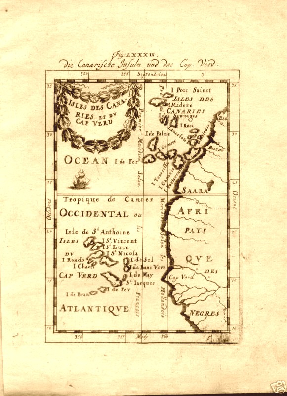
1615 Hondius | 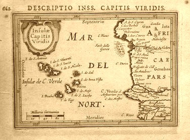 | A little map of the Cape Verde Islands in Africa engraved by Jodocus Hondius and published in one of Petrus Bertius' famous miniature atlases. The Tabularum Geographicarum Contractarum pocket atlas was a popular geography issued in several editions in the late sixteenth and early seventeenth century. Titled "Insulae Capitis Viridis" in the cartouche, the copper engraved page measures 17.5cm by 12.5 cm (5in by 7in) and is hand-colored. Bertius grew up in Flanders and as a young man travelled widely in Europe. He moved to Amsterdam as a refugee from religious persecution and after completing his studies there he was appointed a professor of mathematics and librarian at Leyden University. In 1618 he moved to Paris and became Official Cosmographer to Louis XIII. |
1628 Gerritsz (1)Santiago | 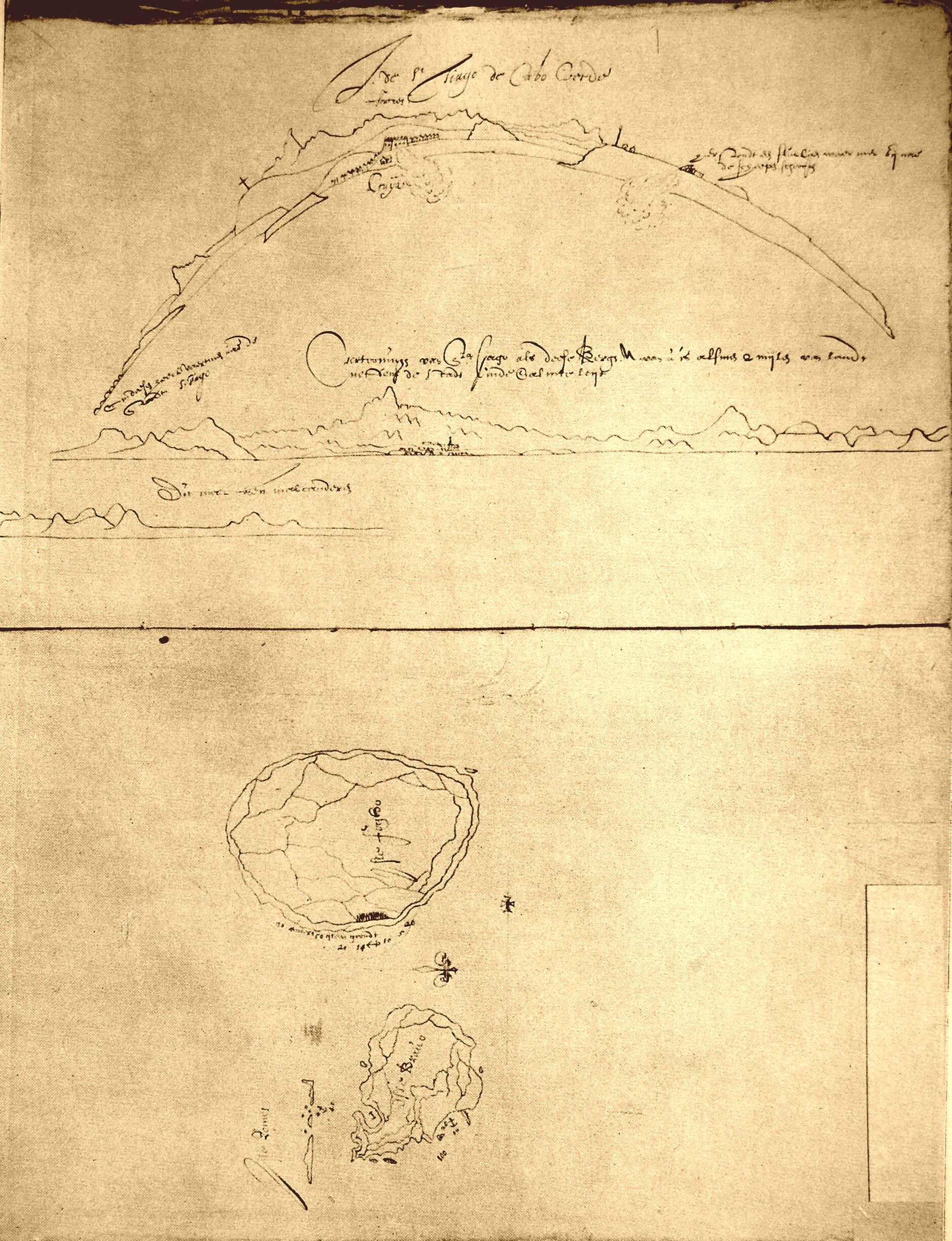 | [Source: Garcia de Orta - Cinco seculos de cartografia das ilhas de Cabo Verde, A. Teixeira da Mota (1961)] |
1628 Gerritsz (2)Mayo | 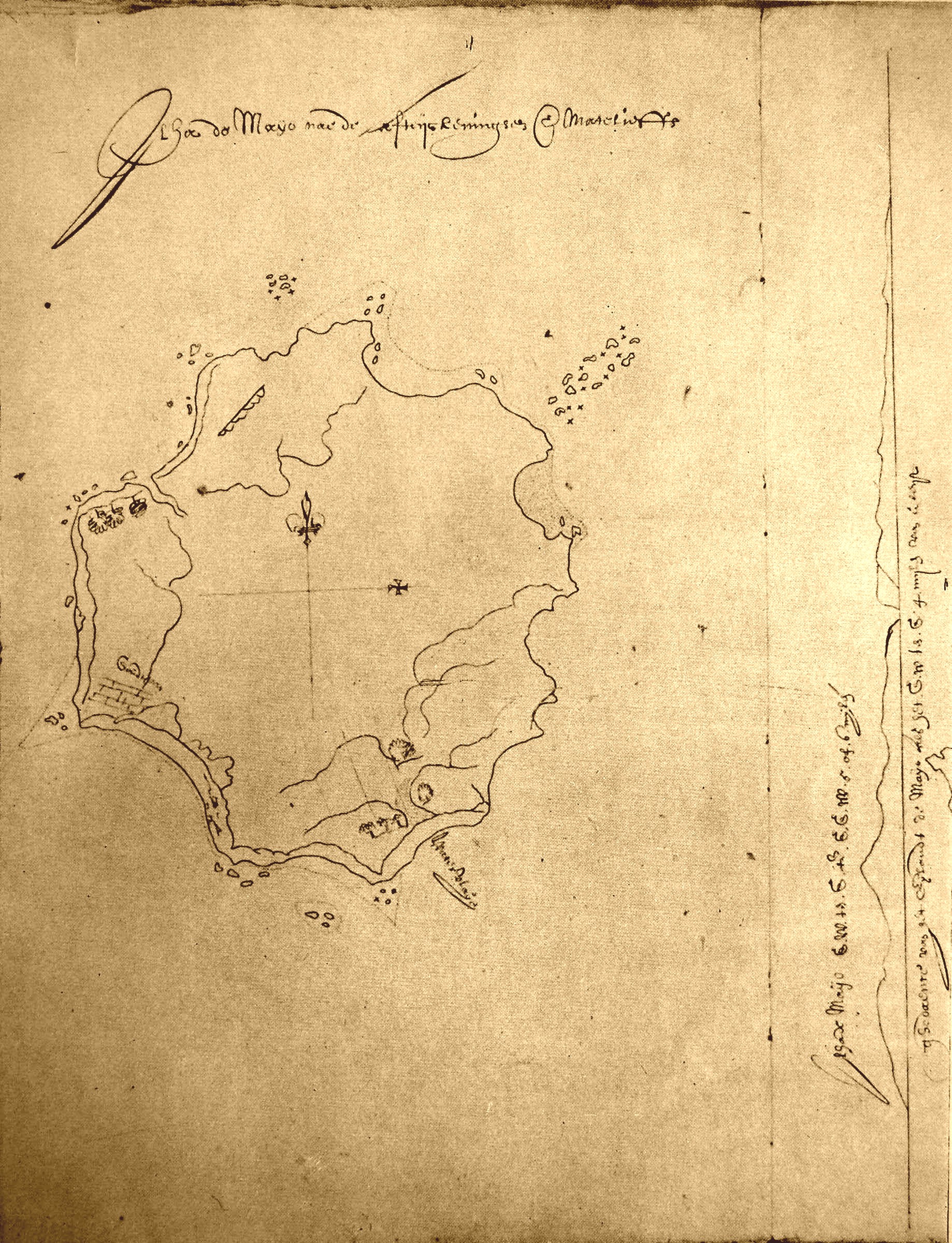 | [Source: Garcia de Orta - Cinco seculos de cartografia das ilhas de Cabo Verde, A. Teixeira da Mota (1961)] |
1670 Ogilby | 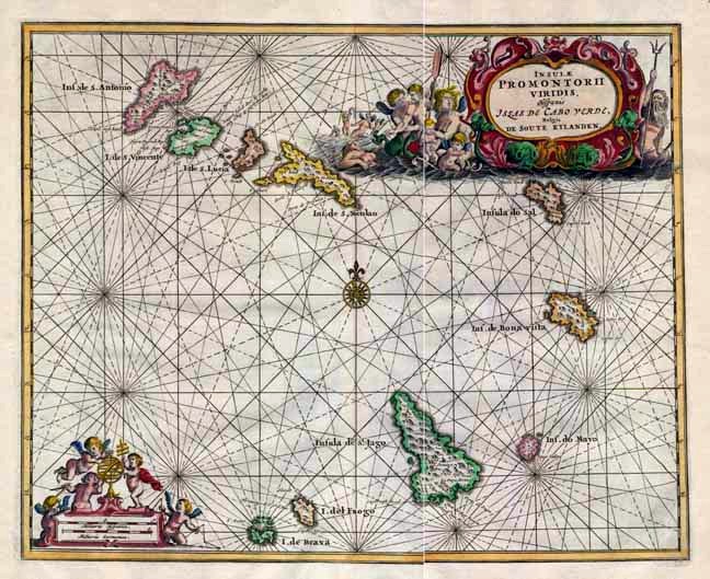 | John Ogilby is one of the most interesting characters associated with maps during the seventeenth century. He was born in Edinburgh and in middle age became a dancing master in the court of Charles II as well as 'Master of Revels' in Ireland. From there he he developed as a geographer and historian and was appointed Royal Cosmographer. His singular achievement was the publication of the first-ever strip road atlas set to the scale of the 1760 yard mile. He had plans for a great world atlas but satisfied himself with translating the works of Arnold Montanus, the great Jesuit historian and collector of travel accounts. This lovely copper engraved map of the Cape Verde Islands comes from his version of Montanus ' Africa' published as 'An Accurate Description and Complete History of Africa' published in 1670, two years after the original. It is a very beautiful, sought-after map because of the decorative surrounding features. The sea has been with mermaids, putti and King Neptune in a title vignette in the top right and a distance scale in the bottom left. There is a compass rose in the centre. The map measures 10" by 12.5" (25cm by 31cm), has later wash hand colouring and is in very good condition except for some browning along the outer edges of the blank margins. It has a centrefold (as issued). |
1683 Sanson | 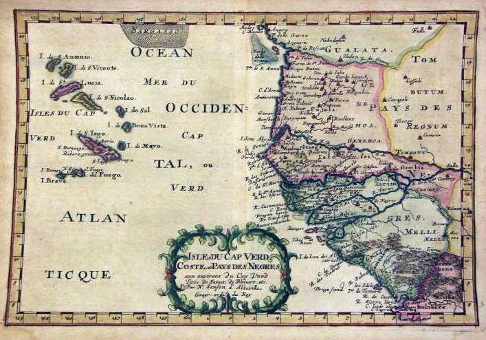 | |
| Details: zoom | ||
| Details: Cape Verde Islands | ||
| Details: West Africa Coast | ||
| Details: West Africa Coast | ||
| Details: West Africa Coast | ||
| Details: Santiago | ||
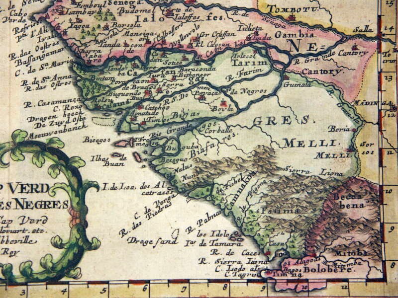
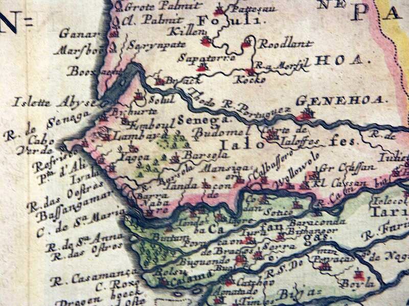
1685 Mallet | 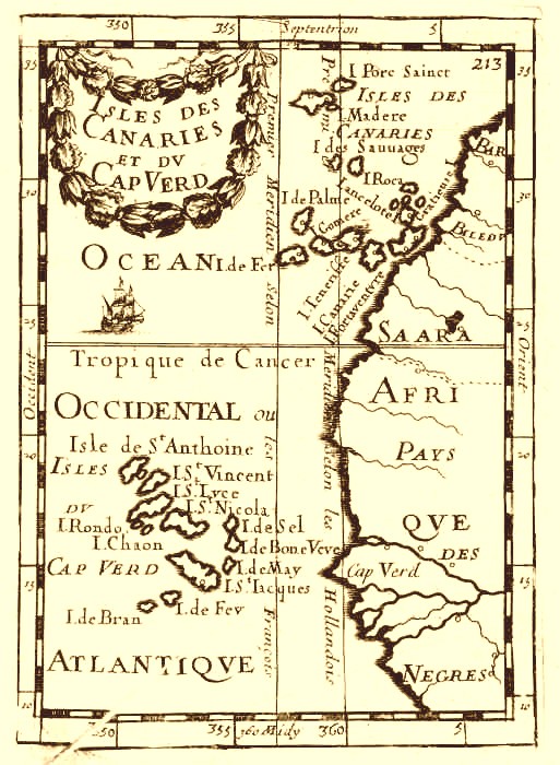 | Copper plate engraving from "Description De L' Univers, Contenant Les Differents Systemes Du Monde", by Allain Manesson Mallet, published by Jean David Zunner in Paris, 1685. Size: The item measures approx 8" x 6", (20 cm x 15 cm). Description: Alain Manesson Mallet (1630 1706) was a French cartographer and engineer. He started his career as a soldier in the army of Louis XIV, became a Sergeant-Major and an Inspector of Fortifications. His major publications were Description de L'Univers (1683) in 5 volumes, and Les Travaux de Mars ou l'Art de la Guerre (1684) in 3 volumes. |
| Reproduction from the German translation (1719) | ||
1730 Valk-Schenk |  | |
1745 Roberts | 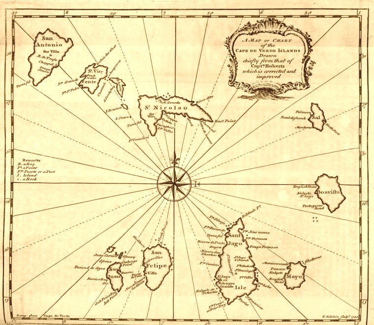 | |
1746 Bellin | 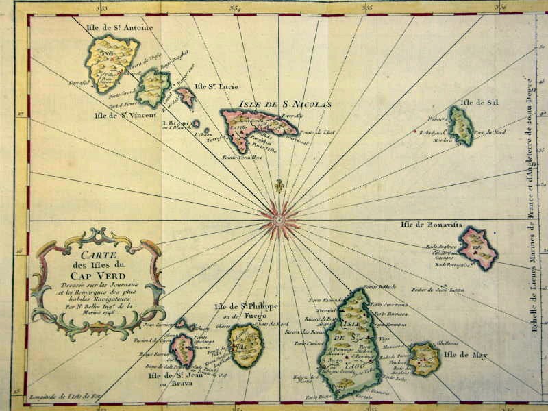 | |
1749 Vaugondy | 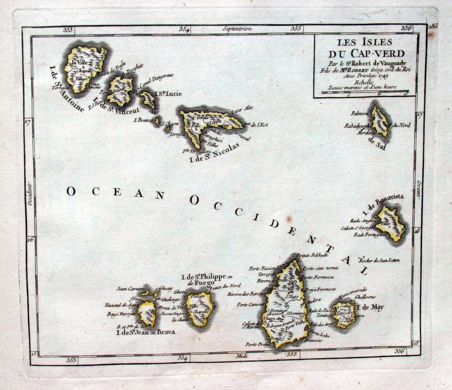 | |
1757 Bellin | 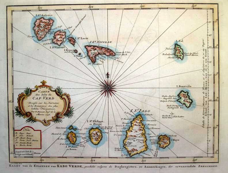 | Description: This large nautical chart of Western African was produced by the French Cartographer Jacques-Nicolas Bellin. Depicts Western Africa from The Canary Islands South through Western Sahara, Senegal, Guinea-Bissau, the Gambia, Guinea, and Sierra Leone. This is primarily a costal chart with depth soundings and navigational marks, but does show the river courses and considerable interior details in the Cape Verde Islands. The remainder of the interior remains largely unmapped. There is a large decorative title cartouche in the upper left as well as a Depot del la Marine stamp in the lower right. All in all, an extraordinary sea chart of Africas northwest coast. Publisher: Jacques-Nicolas Bellin (1703 1772) is one of the most important cartographers of the 18th century. With a career spanning some 50 years, Bellin is an important transitional cartographer. His long career as hydrographer and "Ingénieur Hydrographe" to the Dépôt des cartes et plans de la Marine resulted in the completion of hundreds of high quality nautical charts of practically everywhere in the world. Bellins work focuses on accuracy and tends to be less decorative than the earlier 17th and 18th century work of predecessors such as Homann. In addition to numerous works published during his lifetime, many of his maps were published posthumously. He was succeeded in his position by student Rigobert Bonne. |
1765 Bellin | 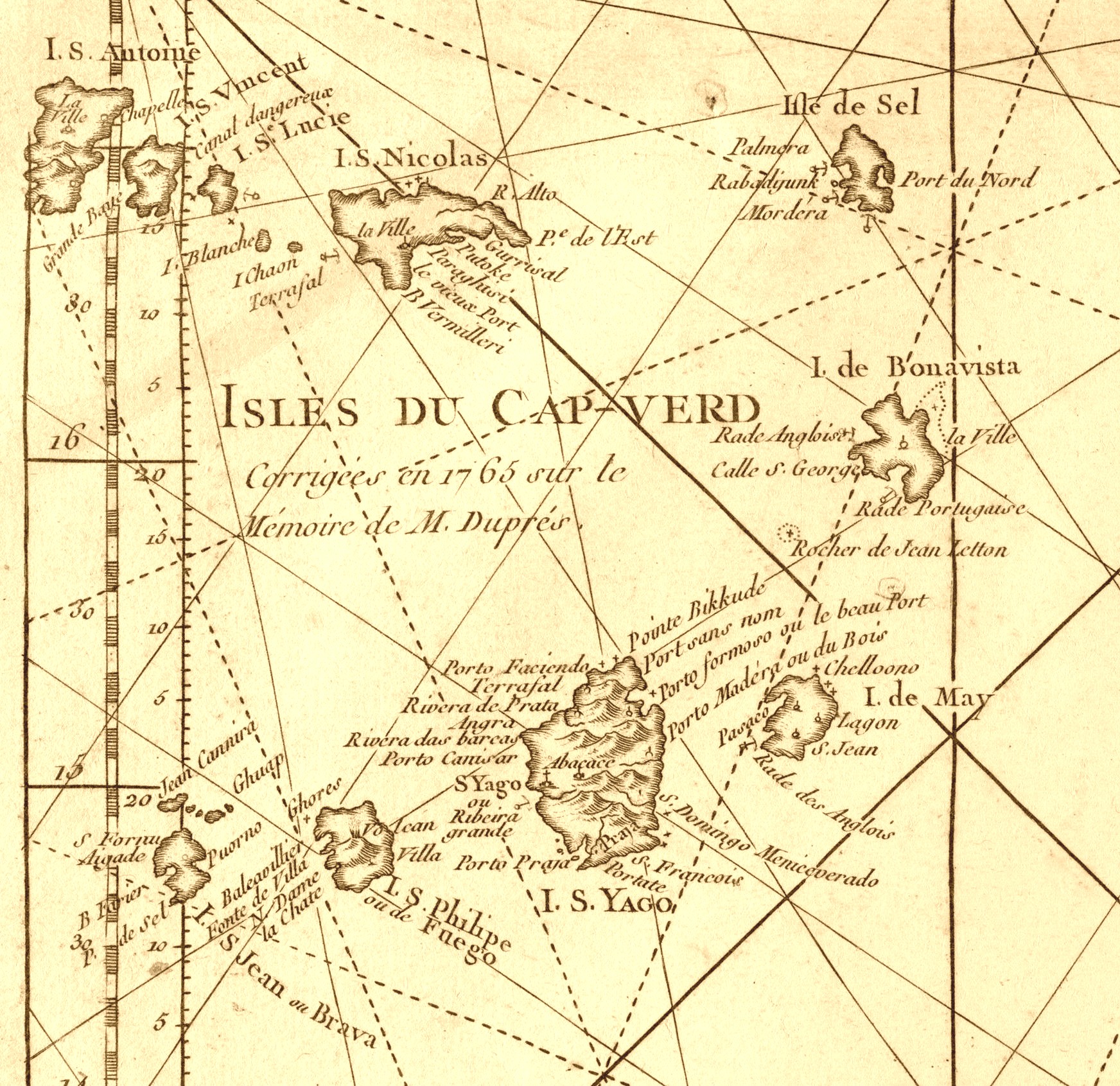 | |
1768 MarquesSao Vicente | 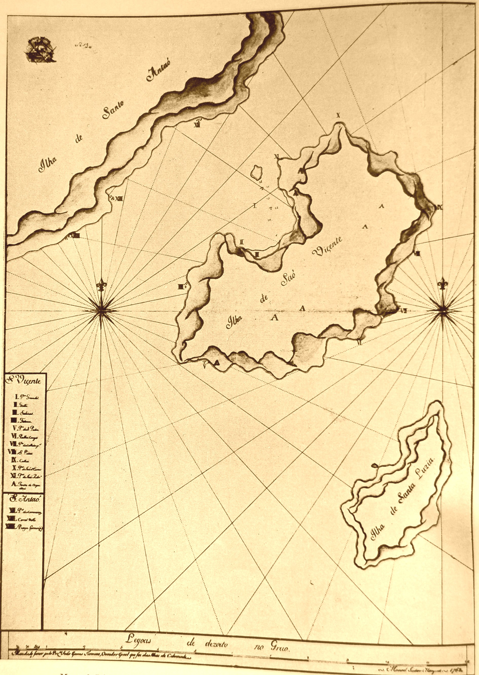 | [Source: Garcia de Orta - Cinco seculos de cartografia das ilhas de Cabo Verde, A. Teixeira da Mota (1961)] |
1769 AnonimoRibeira Grande | 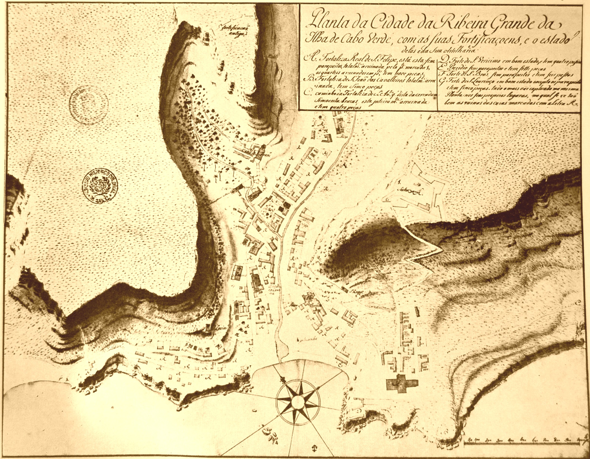 | [Source: Garcia de Orta - Cinco seculos de cartografia das ilhas de Cabo Verde, A. Teixeira da Mota (1961)] |
1772 FleurieuPraia | 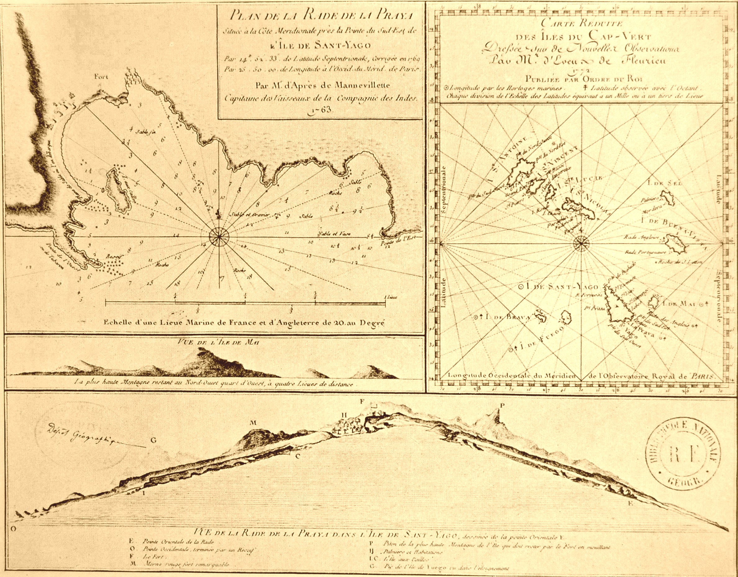 | [Source: Garcia de Orta - Cinco seculos de cartografia das ilhas de Cabo Verde, A. Teixeira da Mota (1961)] |
1777 CookPorto Praia | 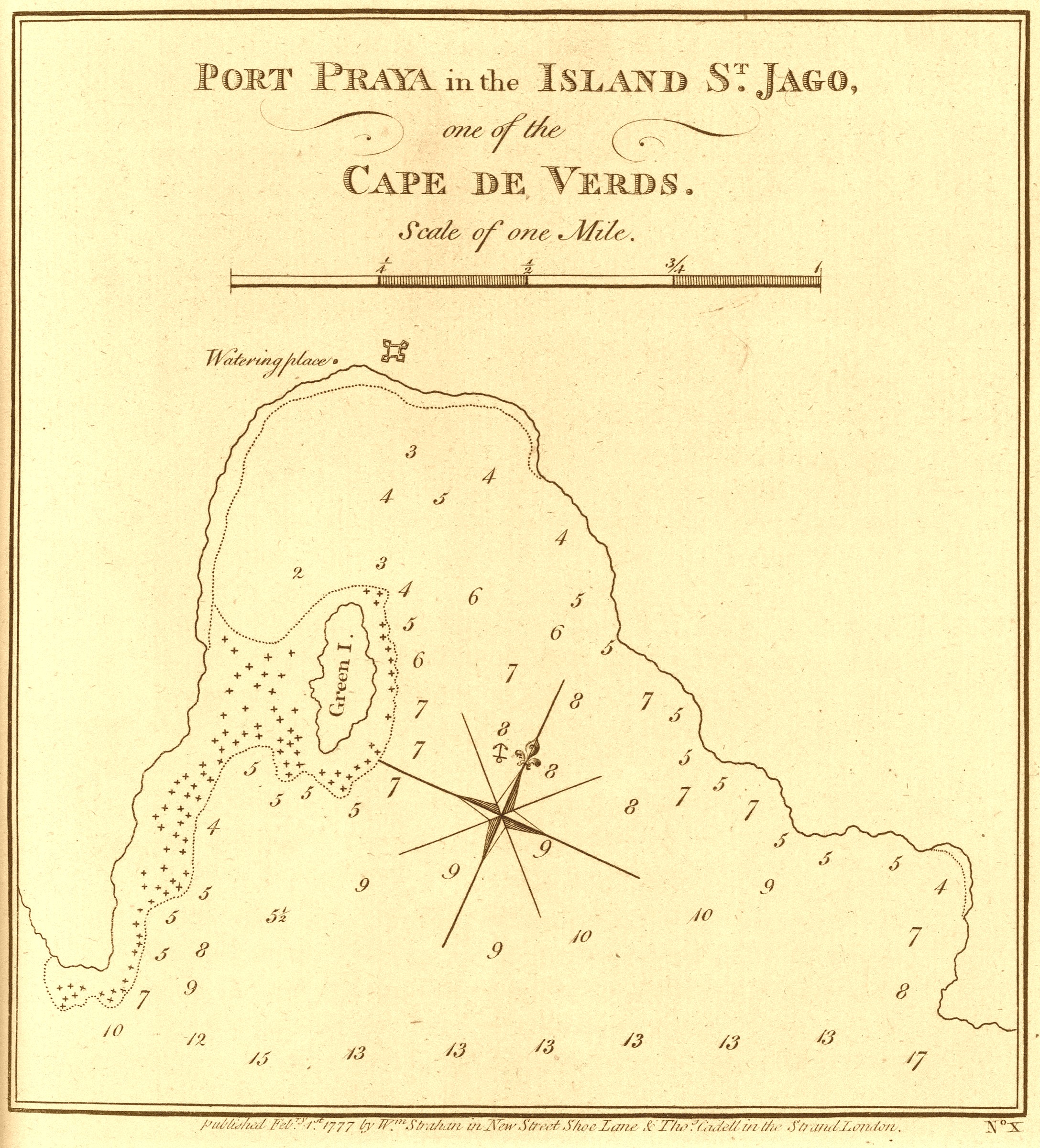 | A voyage towards the South Pole, and round the World. Performed in His Majesty's ships the Resolution and Adventure, in the years 1772, 1773, 1774, and 1775. Written by James Cook, Commander of the Resolution ... In two volumes illustrated with maps and charts ... |
1778 AndreisRibeira Grande |  | [Source: Garcia de Orta - Cinco seculos de cartografia das ilhas de Cabo Verde, A. Teixeira da Mota (1961)] |
1780 Harpe |  | |
1788 Bonne (1) | 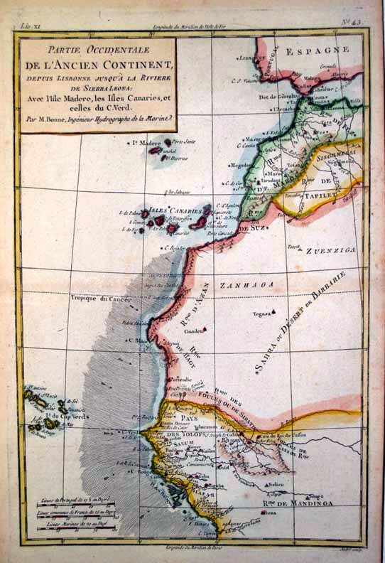 | |
1788 Bonne (2) | 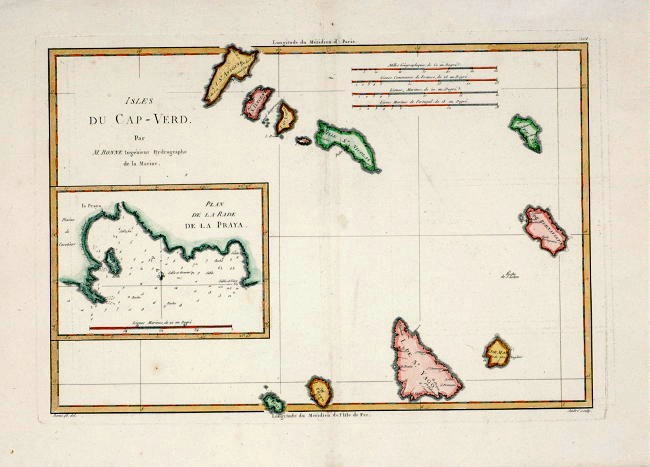 | Title: "CAPE VERDE ISLANDS" Published in Bonne's "Atlas Encyclopedique". 1787. Paris, France. Size: Sheet size of map is 16½" x 11" or 42cm x 28cm. Description: This copper engraved map is by Rigobert Bonne and from the famous "Atlas Encyclopedique". Rigobert Bonne was Royal Hydrographer - his principal interest lay in the production of marine charts but he issued a number of other works, often including maps by fellow cartographers. He also provided maps for a notable atlas by Guillaume Raynal and for an Historical Atlas and Encyclopaedia published in association with Nicolas Desmaret (1725-1805). |
1788 Jefferys |  | The West-India atlas: or, a compendious description of the West-Indies: illustrated with forty one correct charts and maps, taken From actual surveys. Together with an historical account of the several countries and islands which compose that part of the world. |
1790 Cabral | 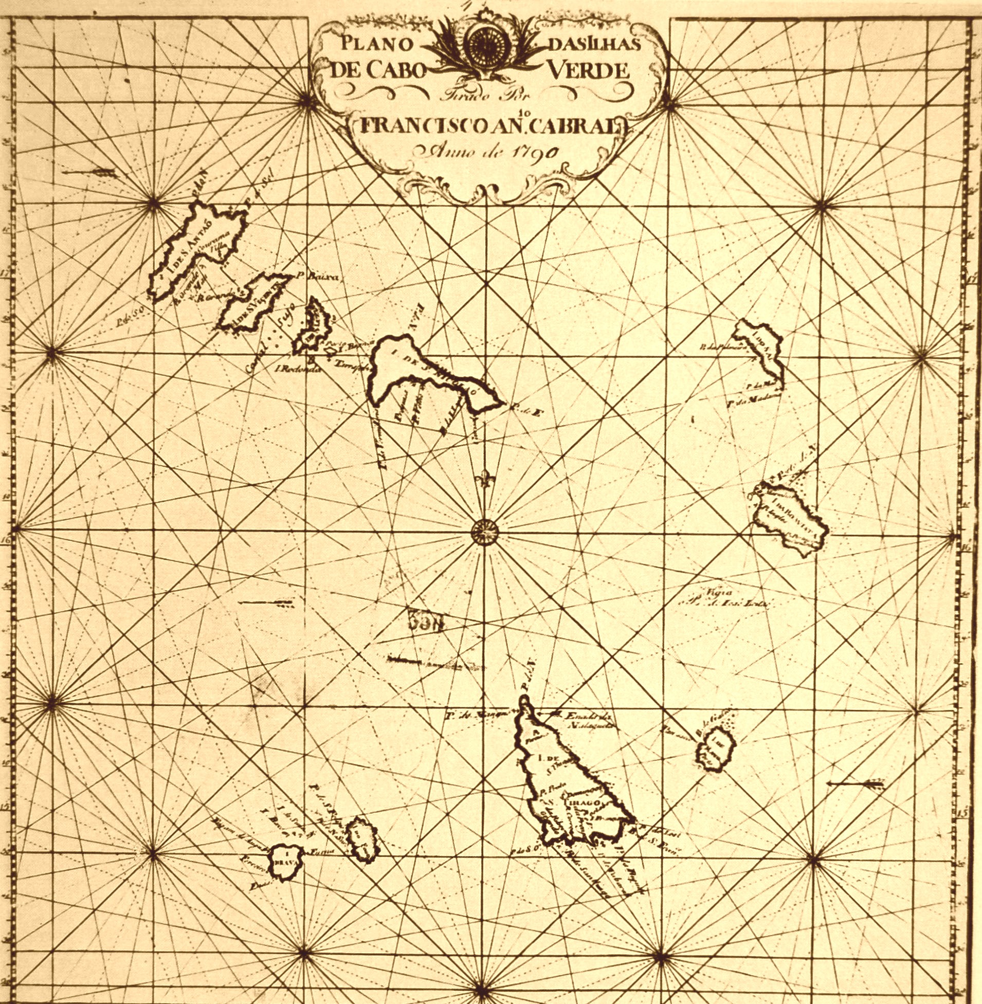 | [Source: Garcia de Orta - Cinco seculos de cartografia das ilhas de Cabo Verde, A. Teixeira da Mota (1961)] |
17xx PittonSantiago | 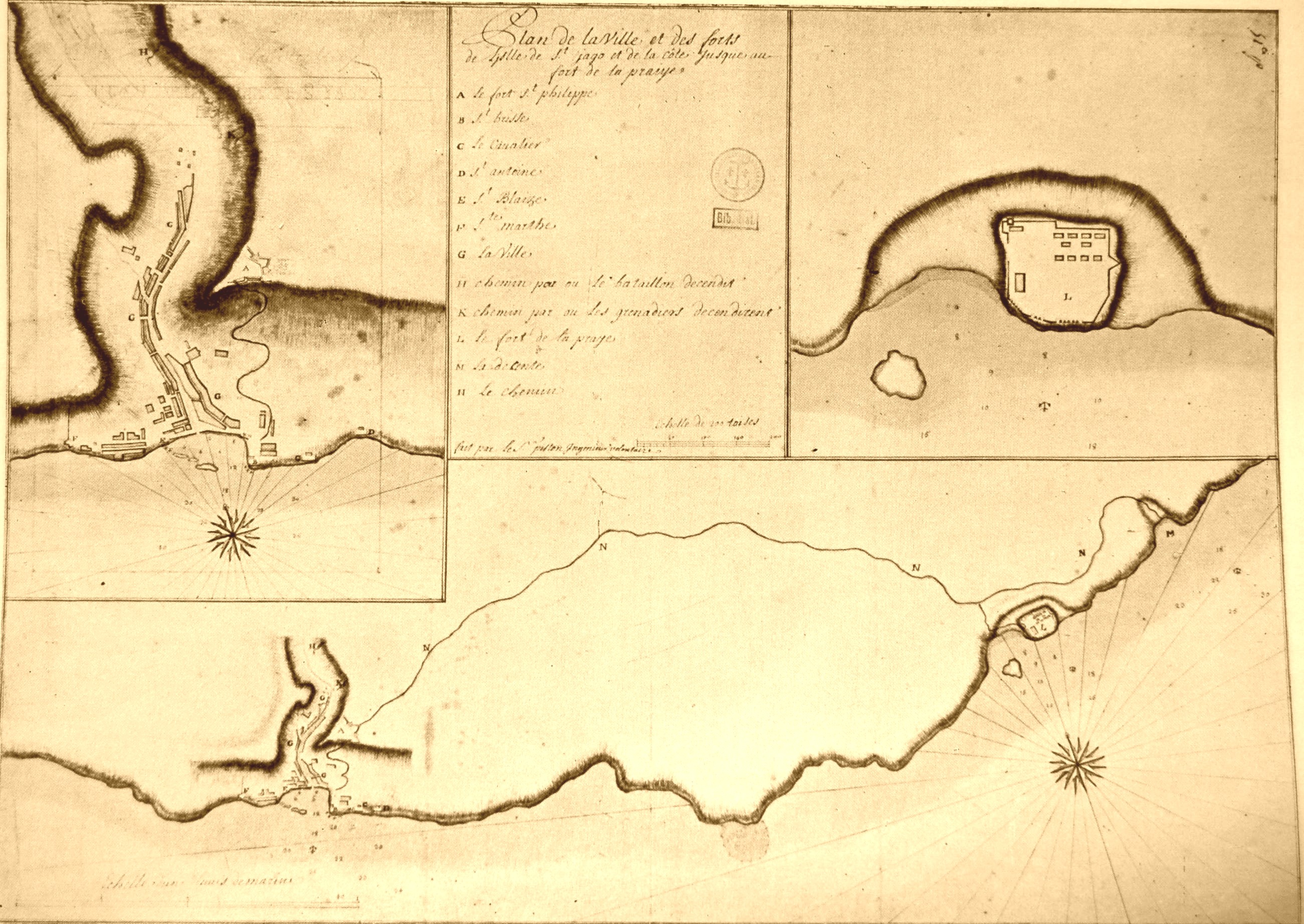 | [Source: Garcia de Orta - Cinco seculos de cartografia das ilhas de Cabo Verde, A. Teixeira da Mota (1961)] |
17xx AndreisSao Vicente | 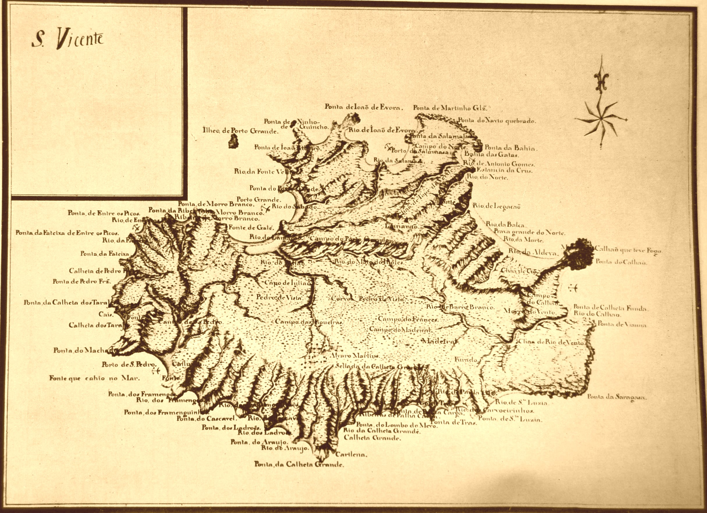 | [Source: Garcia de Orta - Cinco seculos de cartografia das ilhas de Cabo Verde, A. Teixeira da Mota (1961)] |
17xx AndreisSal | 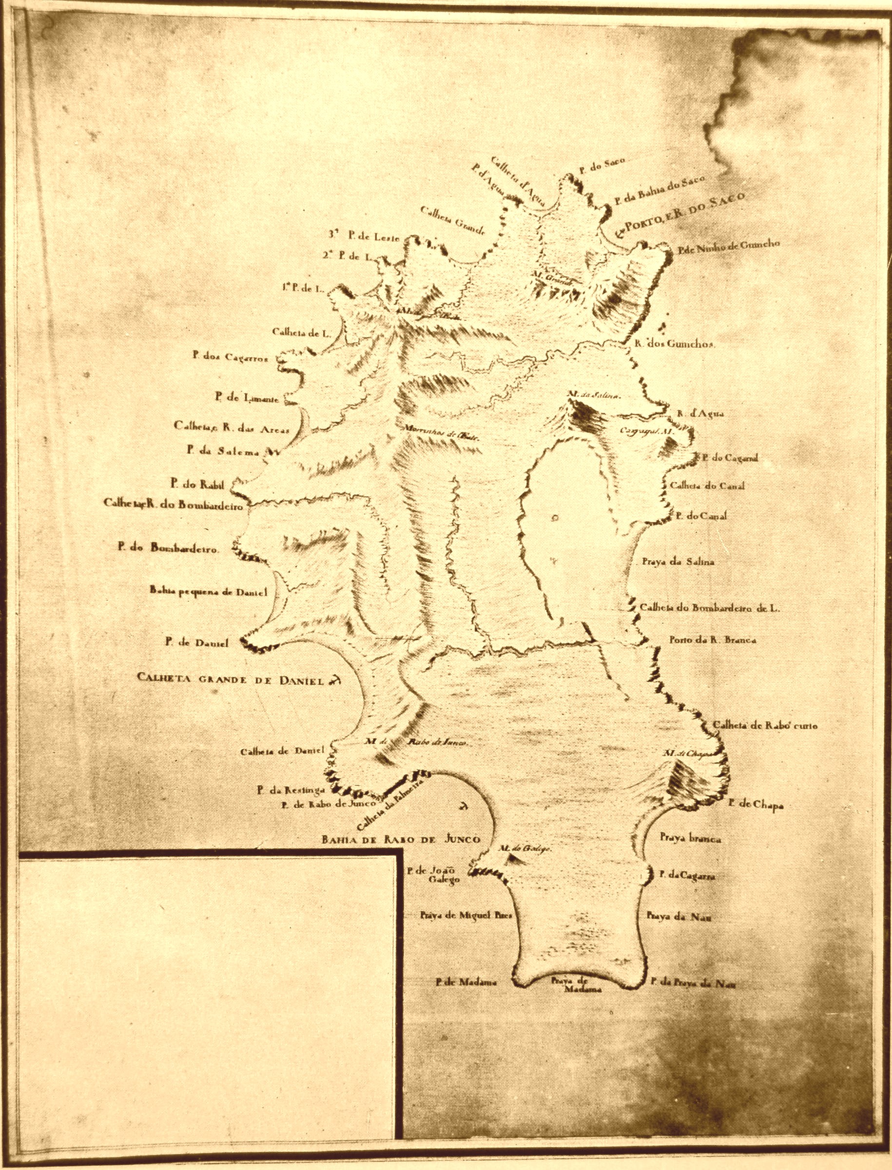 | [Source: Garcia de Orta - Cinco seculos de cartografia das ilhas de Cabo Verde, A. Teixeira da Mota (1961)] |
1814 Thomson | 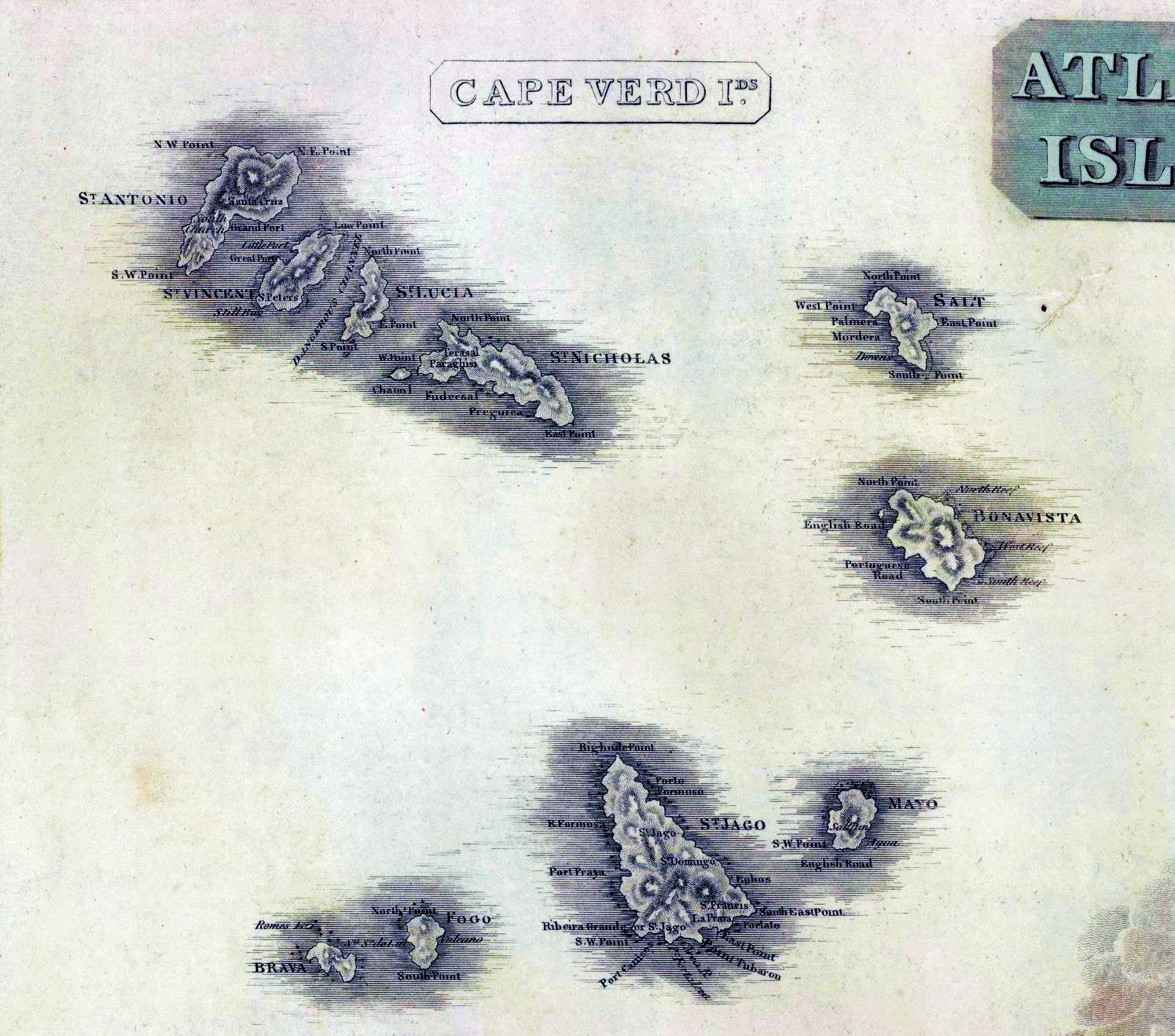 | A new general atlas, consisting of a series of geographical designs, on various projections, exhibiting the form and component parts of the globe; and a collection of maps and charts, delineating the natural and political divisions of the empires, kingdoms, and states in the World. Constructed from the best systematic works, and the most authentic voyages and travels. With a memoir of the progress of geography, a summary of physical geography, and a consulting index to facilitate the finding out of places. Edinburgh: Printed by George Ramsay and Company, for John Thomson and Company, Edinburgh; Baldwin, Cradock, and Joy, London; and John Cumming, Dublin. 1817. |
1819 Vidal/MudgeBoa Vista |  | [Source: Garcia de Orta - Cinco seculos de cartografia das ilhas de Cabo Verde, A. Teixeira da Mota (1961)] |
1820 DurnfordSao Nicolao | 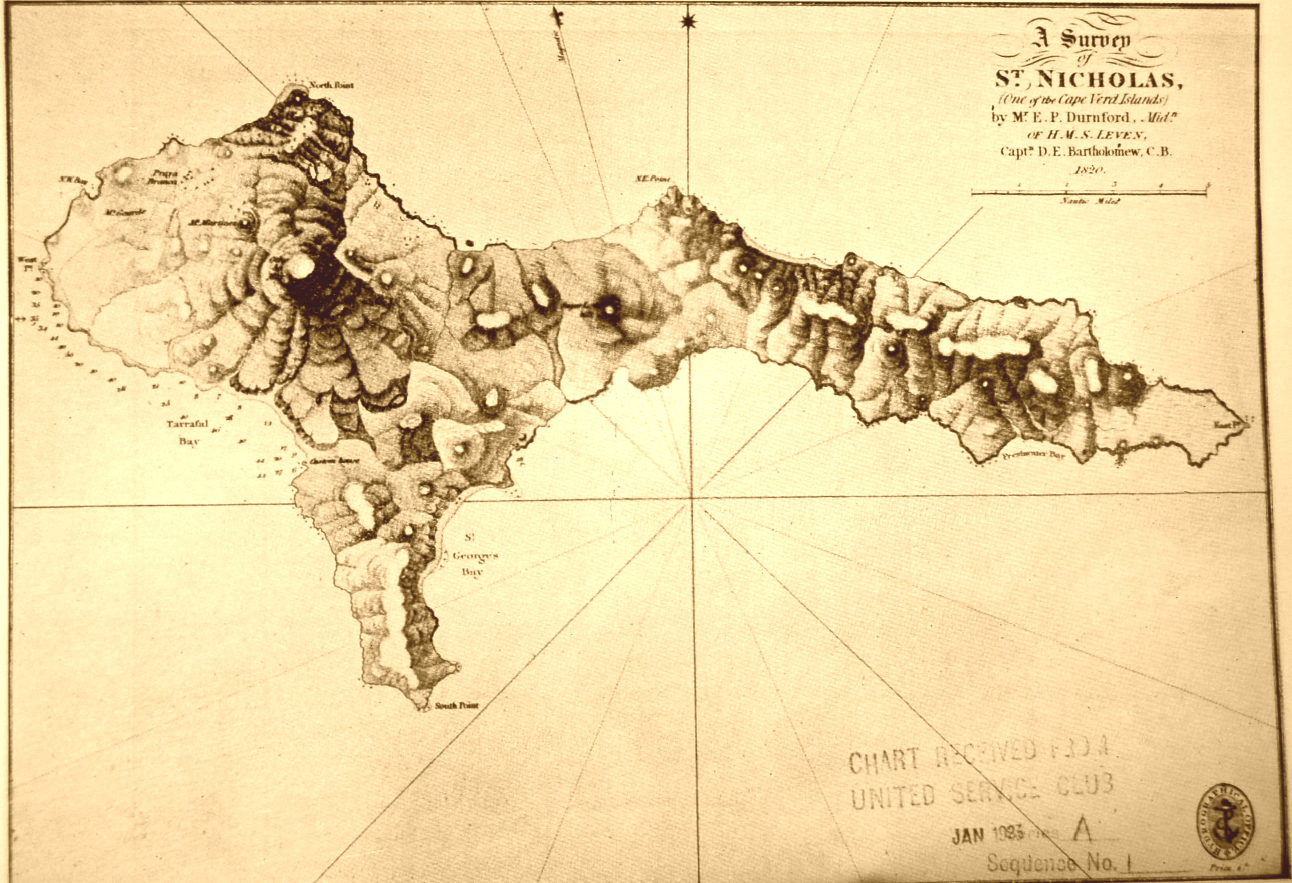 | [Source: Garcia de Orta - Cinco seculos de cartografia das ilhas de Cabo Verde, A. Teixeira da Mota (1961)] |
1820 Vidal/Mudge/DurnfordPorto Grande | 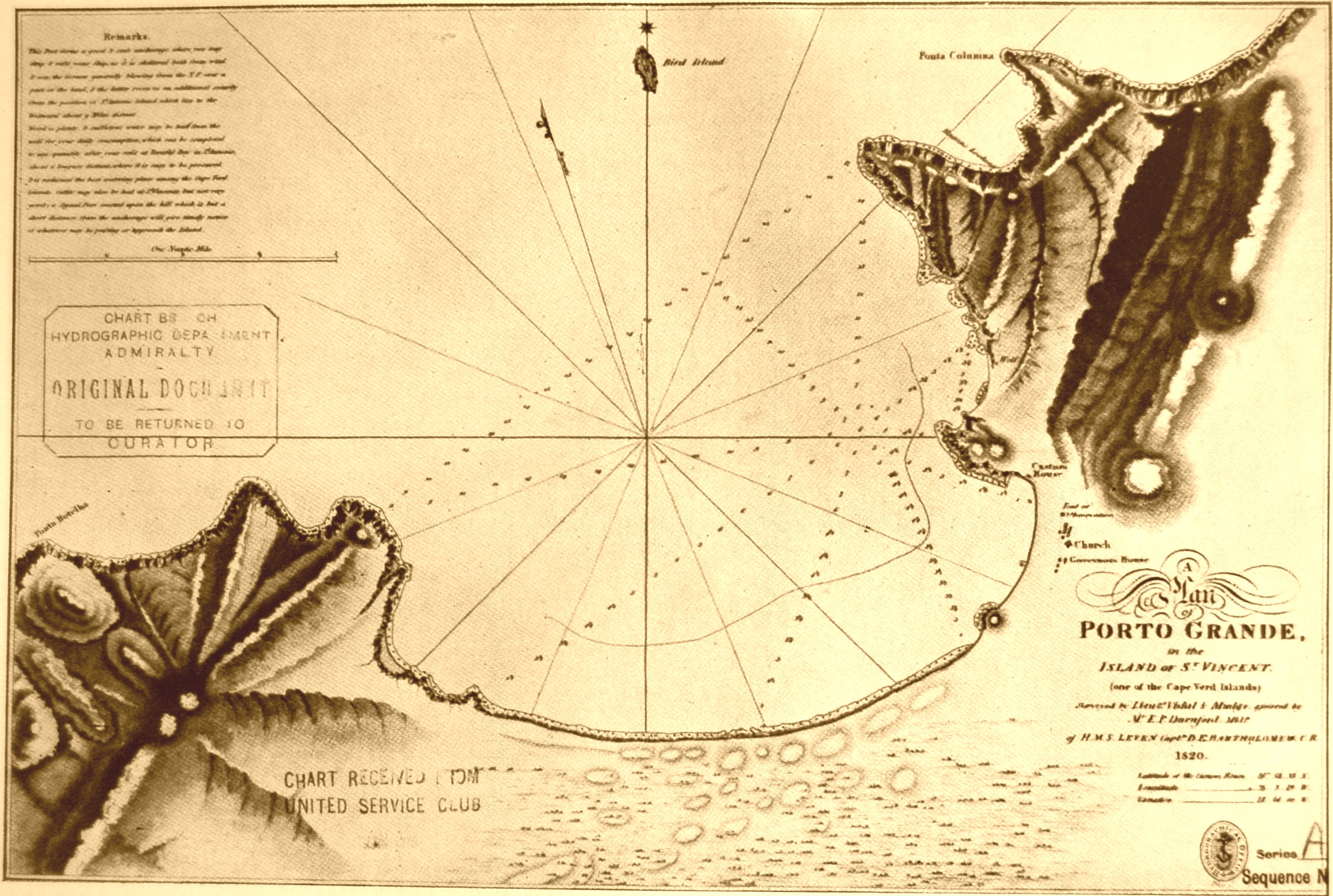 | [Source: Garcia de Orta - Cinco seculos de cartografia das ilhas de Cabo Verde, A. Teixeira da Mota (1961)] |
1823 Fielding | 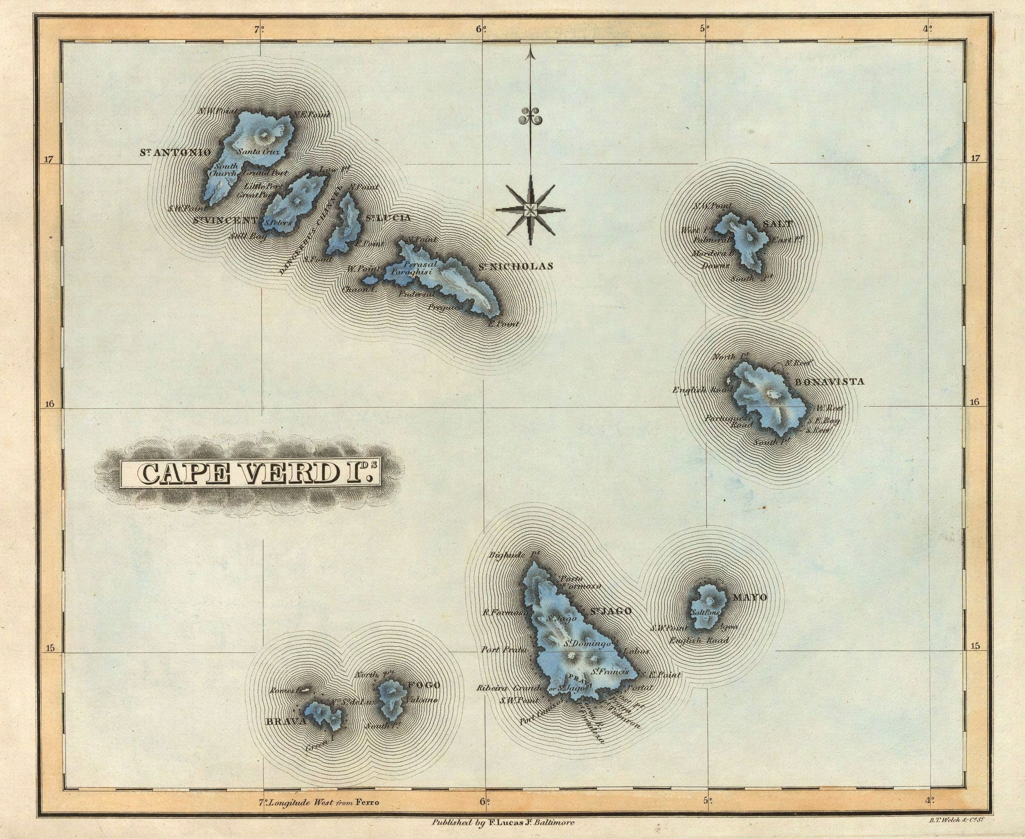 | A General Atlas Containing Distinct Maps Of all the Known Countries in the World, Constructed from the Latest Authority. Written and Engraved by Jos. Perkins, Philadelphia. Baltimore: Published by Fielding Lucas, Jun. No. 138, Market Street. Baltimore. Entered ... by F. Lucas Jr. of the State of Maryland June 3, 1823. The first edition, first state (see our first edition, second state for comparison) of Lucas' best general atlas and the finest general atlas produced in the U.S. at that time (In asserting this we omit the Tanner and Finley American Atlases of 1823 and 1826 respectively because they were not general atlases - cartographically they may have been superior to the Lucas, but not as broad in coverage). The quality of the engraving (most of the U.S. maps were engraved by B.T. Welch, others by Young & Delker, J.V.N. Throop, Cone & Freeman, and Kneass) is superb, the detail is very fine, and the coloring is delicate and elegant. While the same Lucas drawn base maps were used in this atlas and the 1822 American Atlas by Carey and Lea (and thereby created strained relations between him and Carey and Lea), the maps in this Lucas Atlas are far superior in quality - Welch reengraved many of the maps for Lucas that Young & Delker had engraved for Carey and Lea. It is interesting to note that the Carey and Lea maps are usually earlier states of the Lucas maps. The Atlantic Islands and the West Indies Island Maps are mostly copied from Thomson's General Atlas of 1817 (see our copy) as is the Mountains and Rivers plate (reduced). Many maps are derived from the earlier Lucas Atlas of 1815-17 which copied the Oddy Atlas maps for the non U.S. state maps. Some copies have solid color. Maps of Mexico, Canada, and N. America (updated by Lucas in the arctic), are copied from Arrowsmith's General Atlas of 1823 (first ed. was 1817). The classical maps derive from Melish's Atlas of Ancient Geography of 1815. Half leather with marbled paper covered boards, thick outline color, title on spine - "Lucas's Cabinet Atlas." |
1827 Vandermaelen |  | Atlas universel de geographie physique, politique, statistique et mineralogique, sur l'echelle de 1/1641836 ou d'une ligne par 1900 toises, dresse par Ph. Vandermaelen, Membre de la Societe de Geographie de Paris, d'apres les meilleures cartes, observations astronomiques et voyages dans les divers Pays de la Terre; Lithographie par H. Ode, Membre de la Societe de Geographie de Paris. Premier partie. - Europe. Bruxelles. 1827 ... Deuxieme partie. - Asie ... Troisieme partie. - Afrique ... Quatrieme partie. - Amer. sept. ... Cinquieme partie. - Amer. merid. ... Sixieme partie. - Oceanique. (with) Statistique de l'Europe d'apres Hassel. Phillips, 749; Koeman Vdm 1; National Maritime Museum, 179; Wellens-De Donder, L. Philippe Vandermaelen 1795-1869, 4-5. A complete set of the six volume Atlas Universel in original bindings of half red leather teal cloth covered boards with title "Vandermaelen. Atlas Universel..." embossed in gold on the spine. This monumental work was the first atlas of the world with all maps on the same scale (and a large scale at that - about one inch to 26 miles) and the first lithographed world atlas. If all the maps were joined together they would form a globe of 7.75 meters in diameter (such a globe was made in Brussels). The maps were published originally in parts of ten maps each, beginning in 1825 and ending in 1827. Vandermaelen's maps are frequently misunderstood because each map is usually best comprehended in the context of its neighboring maps - the maps do not function well on their own, since they were all meant to be joined. Koeman states that "His atlases, although unique in concept and size did not possess that fine touch of cartographic style which make them attractive for a collector..." We strongly disagree - the graphic art of the maps must be appreciated in the context of lithography, a developing art at the time; as lithographs, they are very well done. For many of the areas depicted, these maps are the largest scale maps made at the time, and the most detailed (particularly in the American West). Maps are hand painted in outline color. |
1827 Letts | 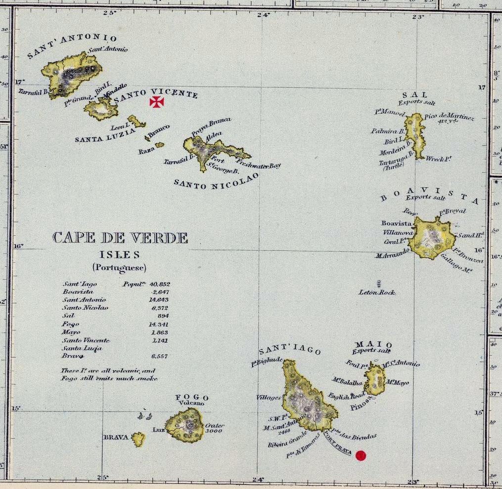 | |
1840 Pereira de MeloPorto da Furna | 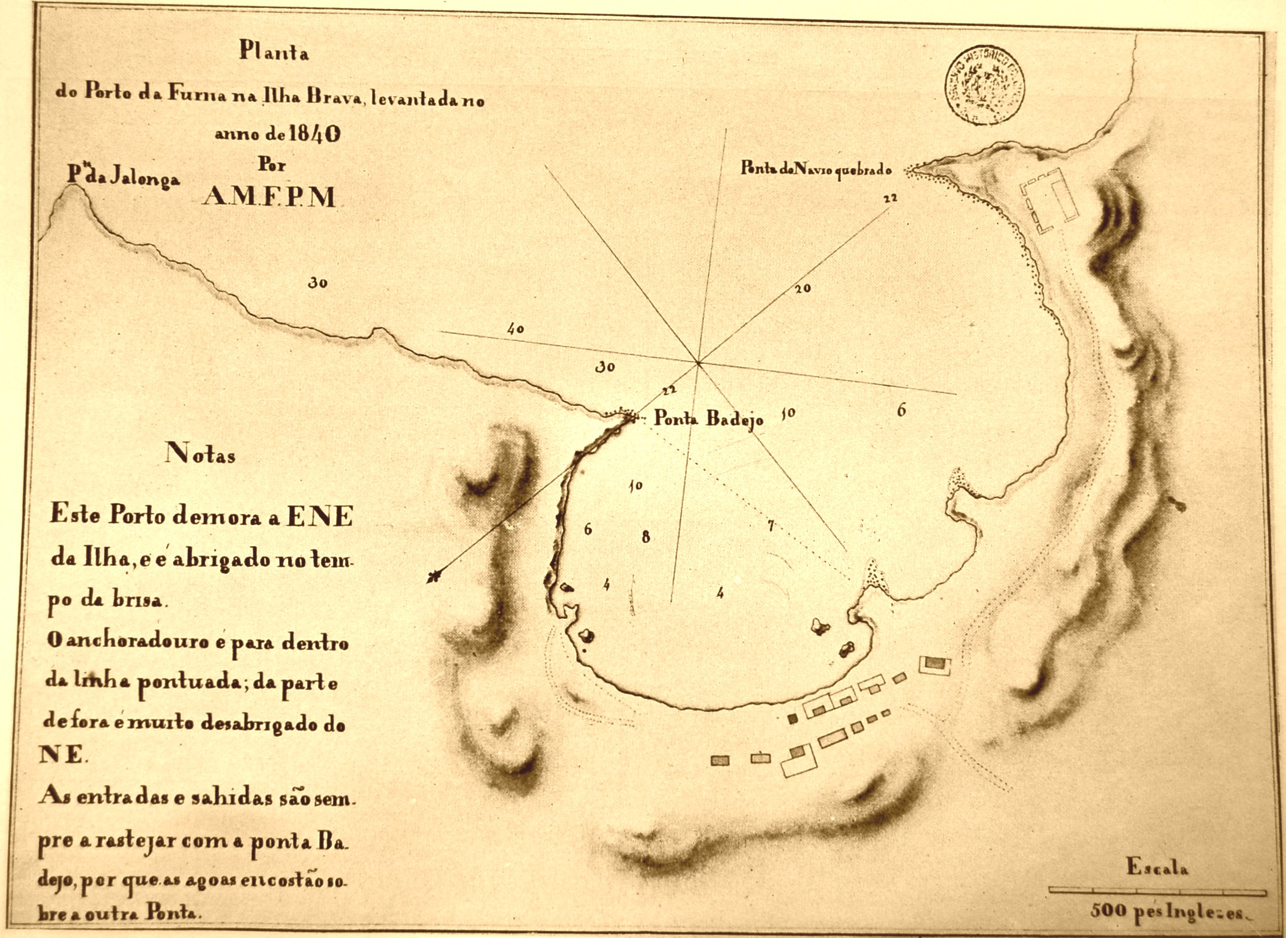 | [Source: Garcia de Orta - Cinco seculos de cartografia das ilhas de Cabo Verde, A. Teixeira da Mota (1961)] |
1844 Lopes da Lima | 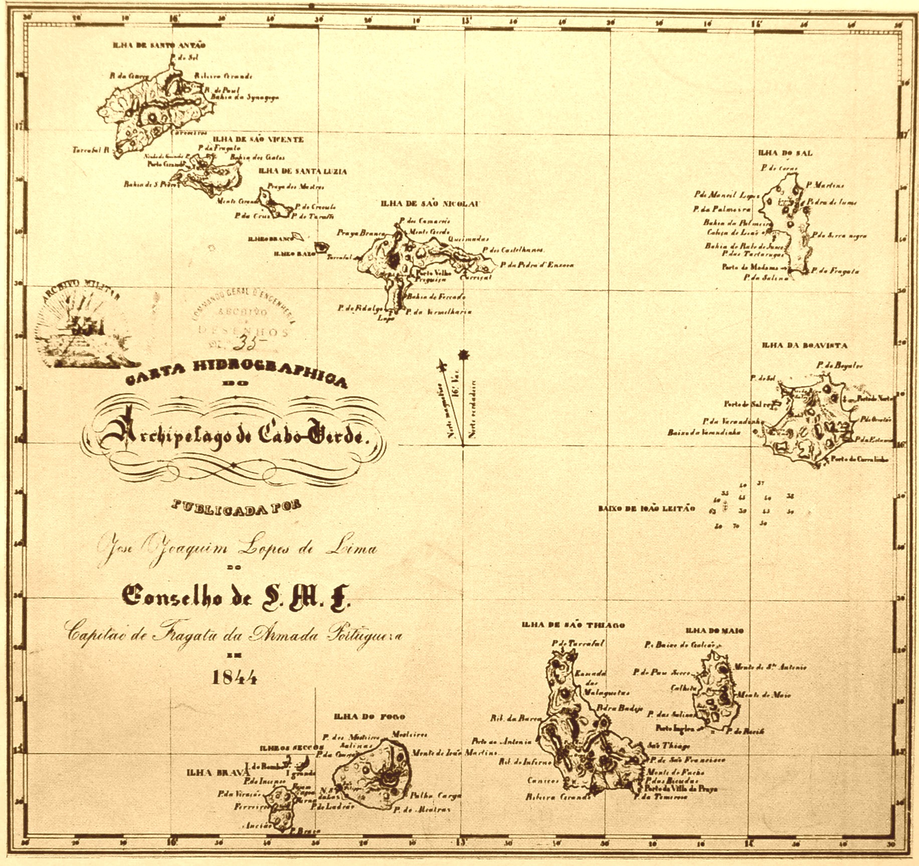 | [Source: Garcia de Orta - Cinco seculos de cartografia das ilhas de Cabo Verde, A. Teixeira da Mota (1961)] |
1850 Swanston | 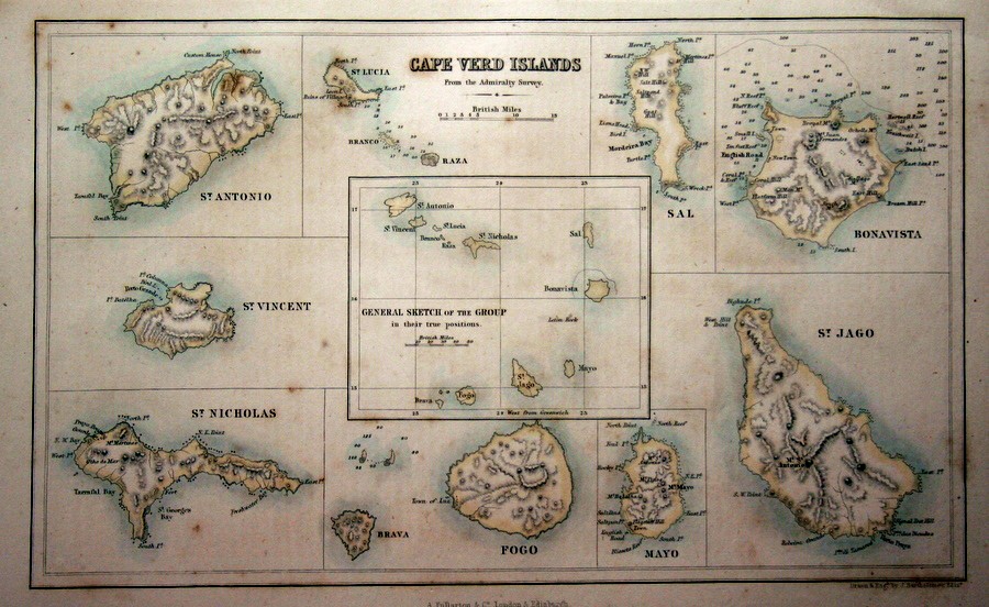 | This map engraved by G.H. Swanston is from, "A Gazetteer of The World" published by A. Fullarton, Edinburgh, 1850. Size: The map measures approx 10" x 7", (25 cm x 18 cm). |
1887 VasconcelosSal | 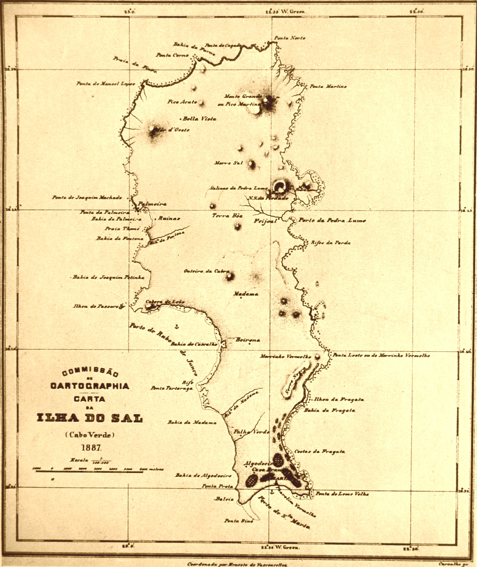 | [Source: Garcia de Orta - Cinco seculos de cartografia das ilhas de Cabo Verde, A. Teixeira da Mota (1961)] |
1900 Sena BarcelosSao Filippe | 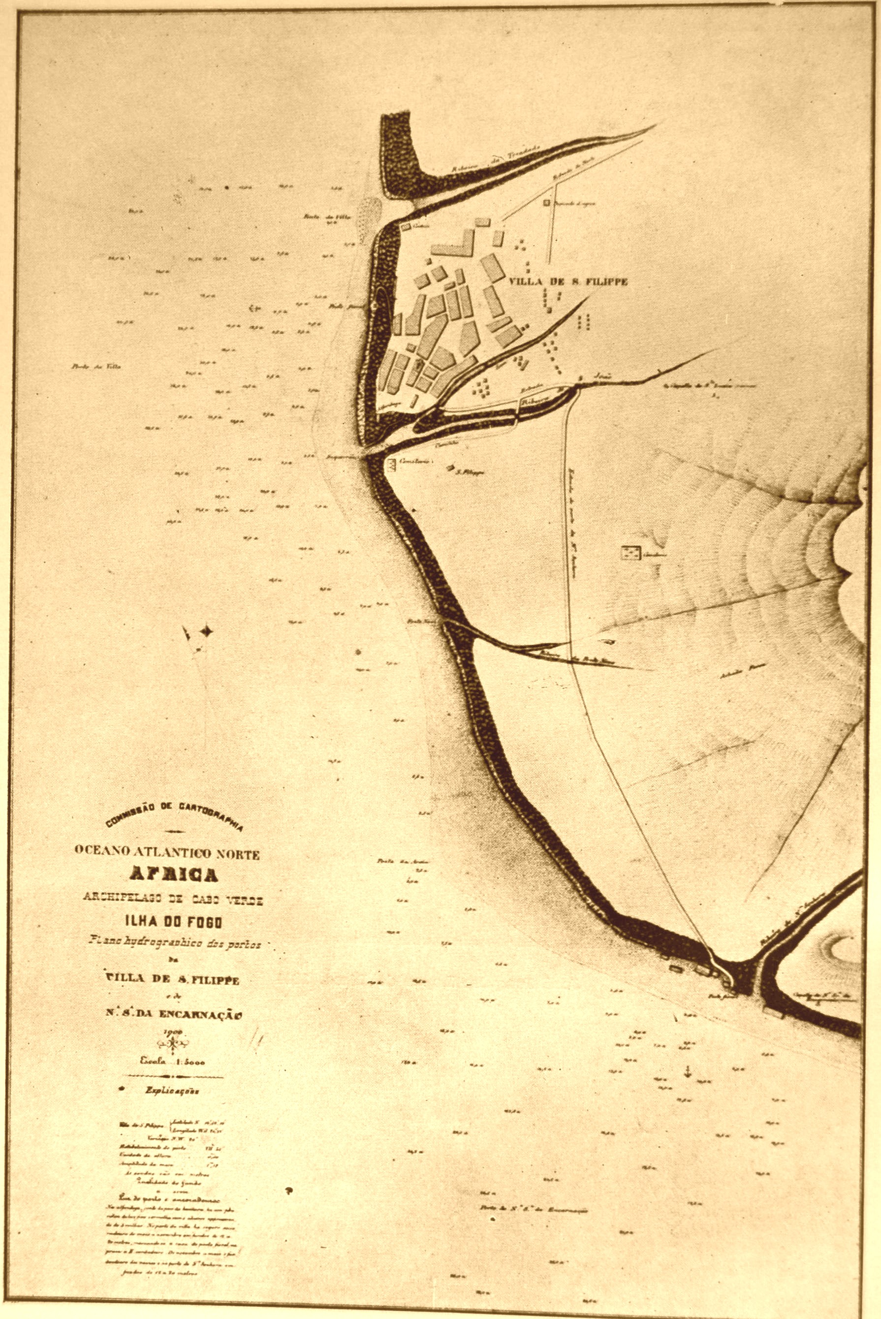 | [Source: Garcia de Orta - Cinco seculos de cartografia das ilhas de Cabo Verde, A. Teixeira da Mota (1961)] |
1932 Missao GeograficaSao Vicente | 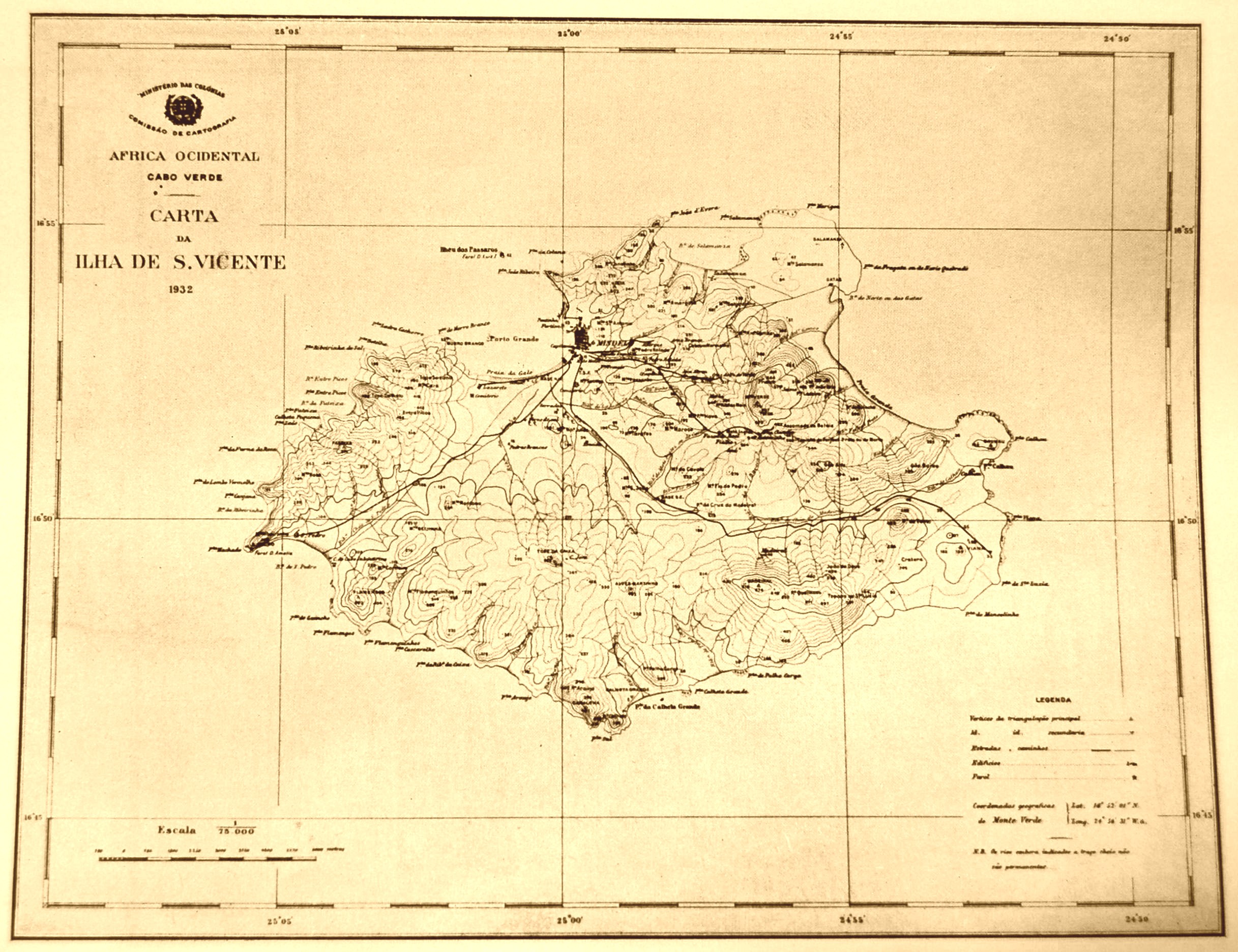 | [Source: Garcia de Orta - Cinco seculos de cartografia das ilhas de Cabo Verde, A. Teixeira da Mota (1961)] |
1958 Missao HidrograficaPorto do Tarrafal | 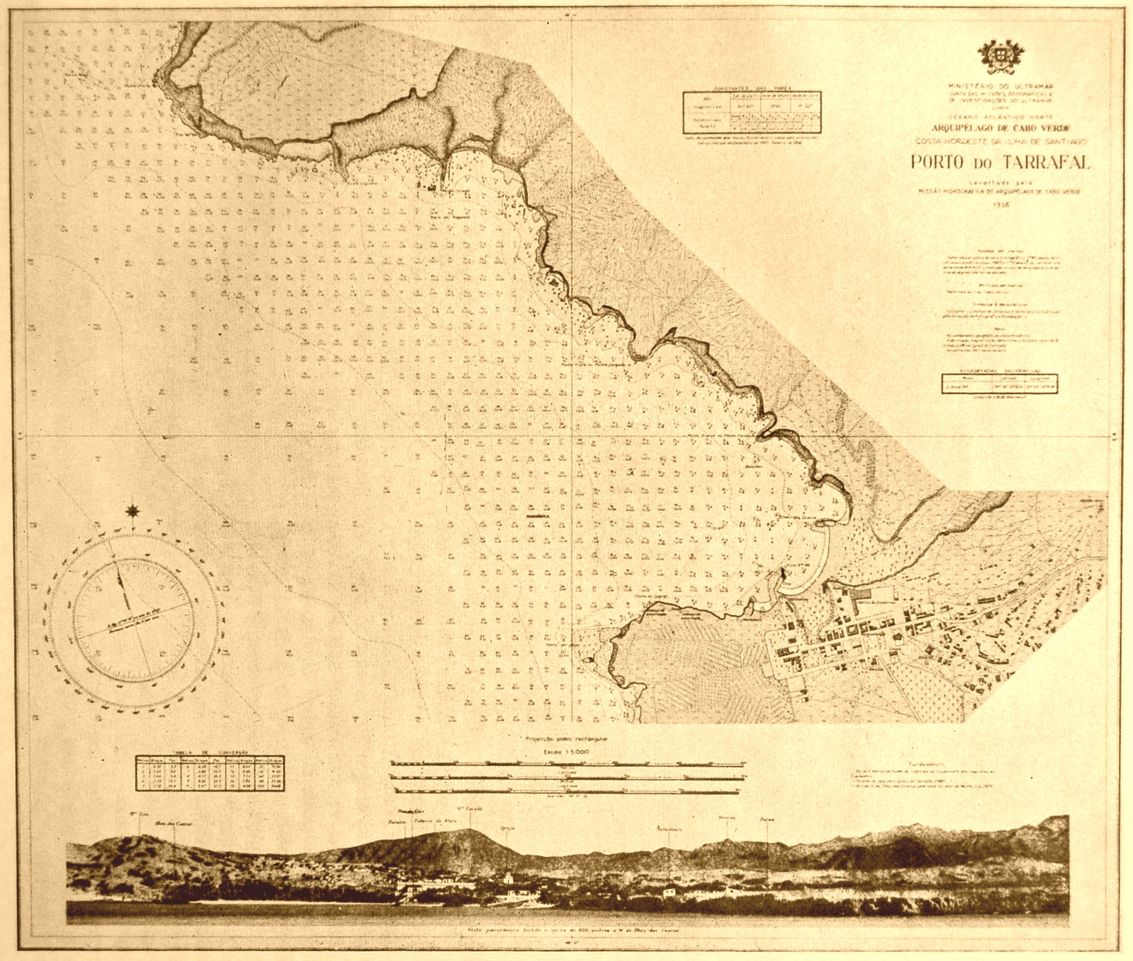 | [Source: Garcia de Orta - Cinco seculos de cartografia das ilhas de Cabo Verde, A. Teixeira da Mota (1961)] |
Nasa Astronauts Images | 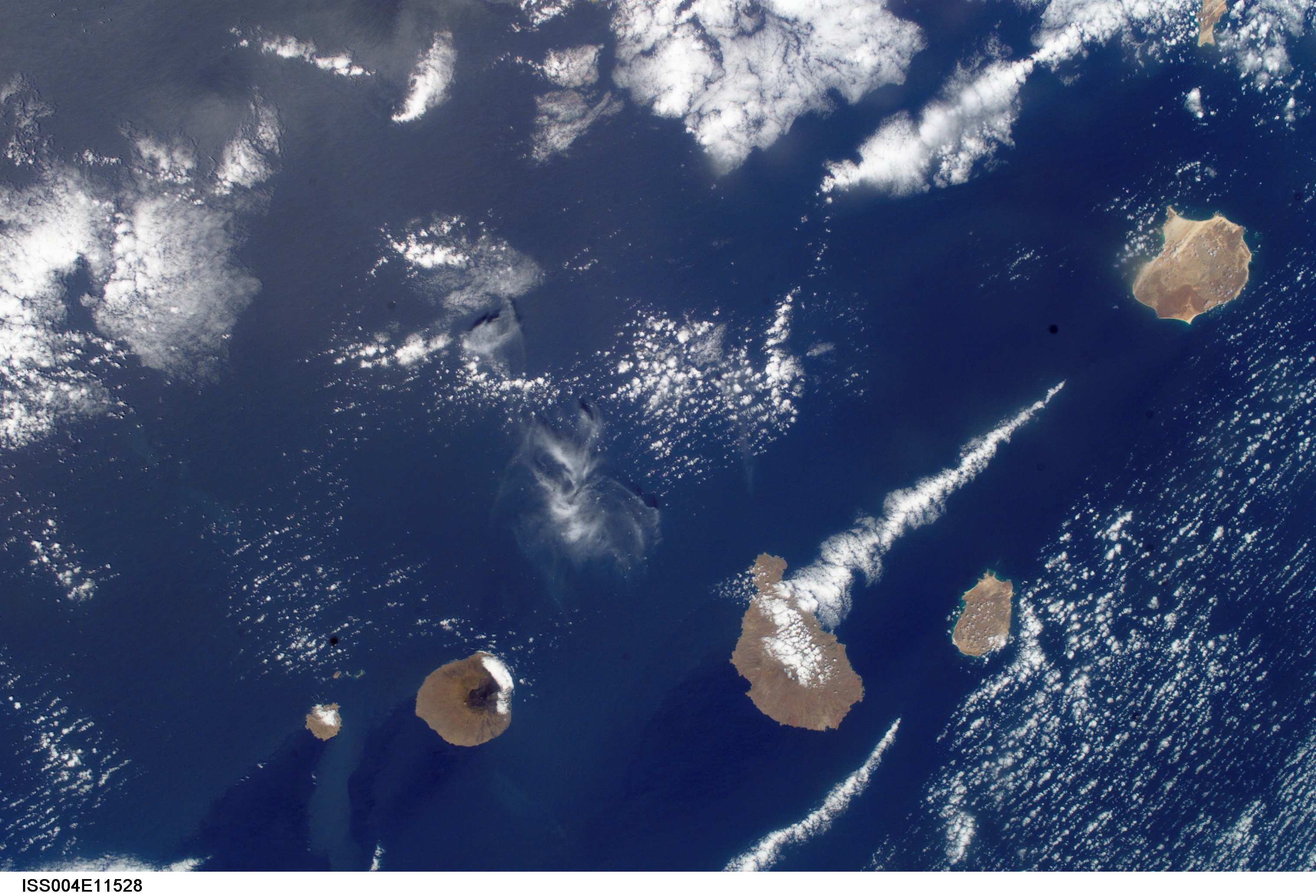 Ilhas de Sotavento Santiago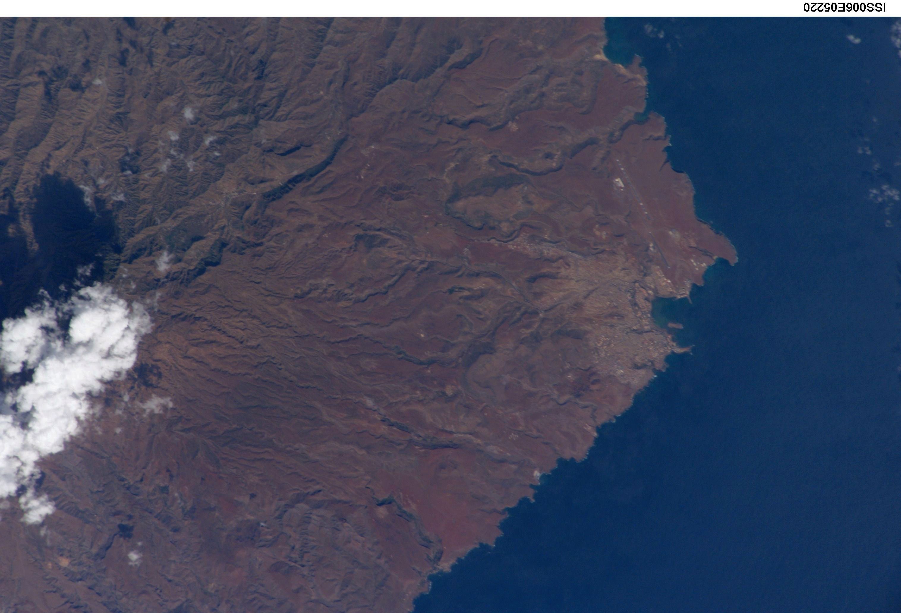 Praia | |